Remote sensing image databases
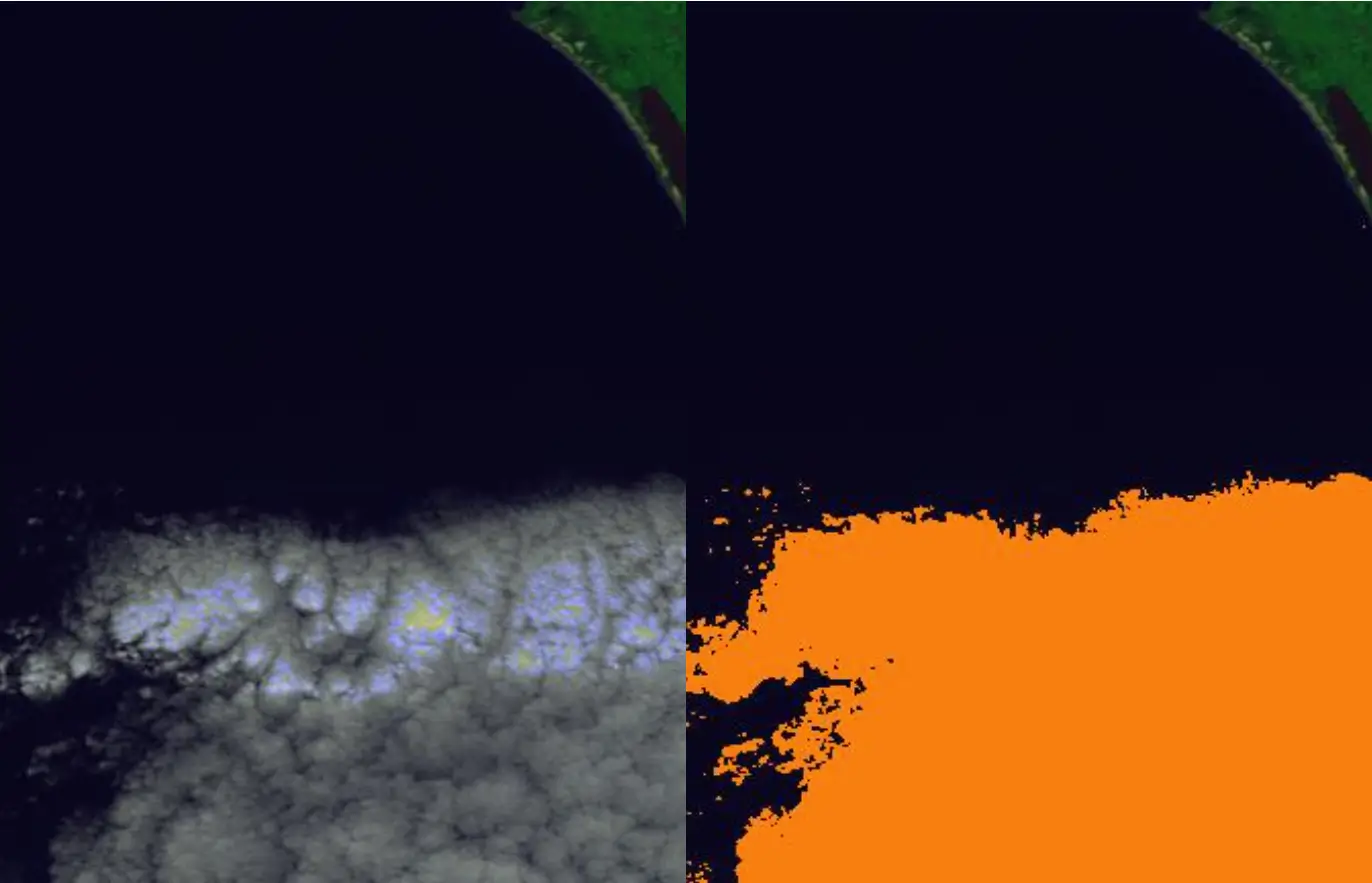
CloudSEN12
A Benchmark Dataset for Cloud Semantic Understanding
Global Leaf Traits Products with Machine Learning
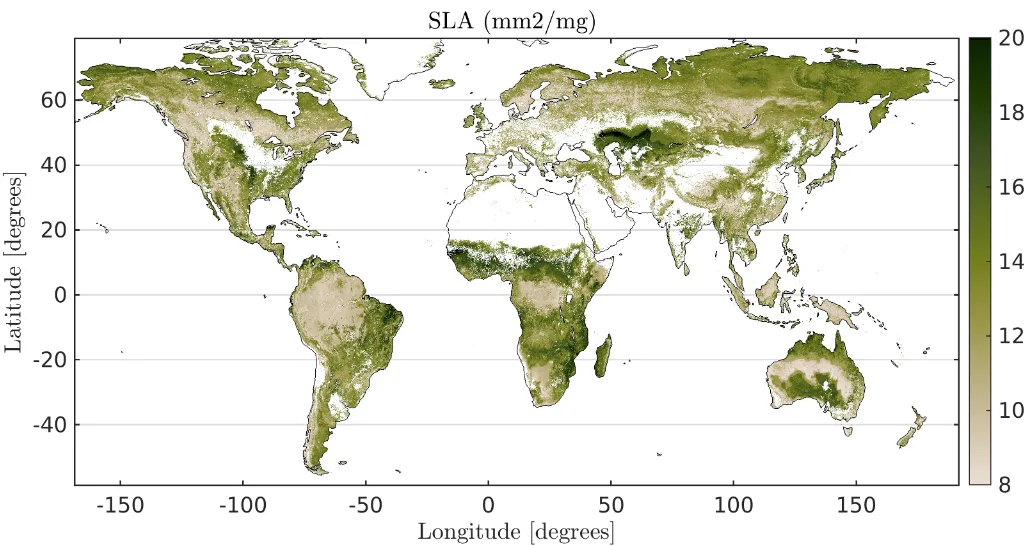
We provide global high-resolution maps of leaf traits. In particular, we present global maps of specific leaf area, leaf dry matter content, leaf nitrogen and phosphorus content per dry mass. The methodology combines MODIS and Landsat data, climatological data, the TRY database and machine learning algorithms.
References
- Moreno-Martínez, Á., Camps-Valls, G., Kattge, J., Robinson, N., Reichstein, M., Bodegom, P. V., Kramer, K., Cornelissen, J. H. C., Reich, P. B., Bahn, M., Niinemets, Ü., Peñuelas, J., Craine, J., Cerabolini, B., Minden, V., Laughlin, D. C., Sack, L., Allred, B., Baraloto, C., Byun, C., Soudzilovskaia, N. A., Running, S. W. (2018). A methodology to derive global maps of leaf traits using remote sensing and climate data. Remote Sensing of Environment, 218, 69-88. doi:10.1016/j.rse.2018.09.006
HyperLabelMe: A web platform for benchmarking remote-sensing image classifiers
The Image and Signal Processing (ISP) group at the Universitat de València has harmonized a big database of labeled multi- and hyperspectral images for testing classification algorithms. We provide training pairs (spectra and their labels) and test spectra. Researchers are able to train their algorithms off-line, and then evaluate their accuracy over an independent, fixed, spectra test set per image. The system returns accuracy and robustness measures of your algorithm in that test set, as well as a ranked list of the best methods.
References
- J. Munoz-Mari et al., ‘HyperLabelMe : A Web Platform for Benchmarking Remote-Sensing Image Classifiers,’ in IEEE Geoscience and Remote Sensing Magazine, vol. 5, no. 4, pp. 79-85, Dec. 2017. doi: 10.1109/MGRS.2017.2762476
LM database: the 7 million MSG labeled image chips challenge for cloud classification
The database contains 7 million multispectral images from the MSG sensor. Images correspond to 200 landmark locations in the globe during 2010. They are fully labeled with cloud vs cloudfree classes. The main goal is the automatic detection of clouds over landmarks, which is a challenging classification problem.
Proba-V Cloud Cover Dataset